|
|
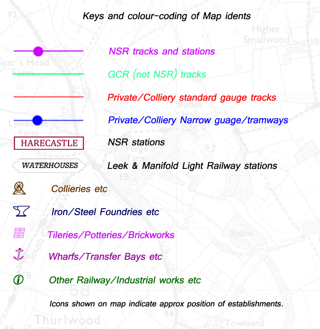
North Staffordshire Railway
Map
I am often asked, due to my interest in local railways, where
certain long-gone rail tracks used to run, including both
main line and industrial. It occurred to me to create a new
map of the North Staffs Railway era (1848 - 1923), showing
all its routes overlaid on a modern-day map background. Thus
people can then relate to where the rails would be if still
in place. It would perhaps encourage them to have a look to
see if anything remained of the trackbed and infrastructure.
The map covers the NSR area mainly in the Potteries and South
Cheshire and easterly as far as the Leek and Manifold Light
Railway.
Railways in that era depended on and serviced the vast amount
of industrial establishments like collieries, tileworks, potteries,
iron and steel foundries and others, where most linked to
the main lines via their own private network of railways.
These were mainly standard gauge but there were also a lot
of narrow-gauge and tramways that littered the area. To make
my map more complete I had to try and include these too, even
if some were closed before the NSR era commenced.
It is impossible to create a 'snapshot' of a particular day
in the NSR era as track layouts were often changed, added
and demolished, so I have tried to supply a composite view
of everything that was ever in existence during its time.
Obviously due to the importance of the collieries and industrial
workings, I have supplied the locations of these too.
It must be understood that I cannot guarantee the completeness
or total accuracy of what I have supplied, but I have done
my best to show where everything was in NSR days.
I would appreciate feedback on any inaccuracies, omissions,
or suggestions for inclusion in a later update. Please contact
me click here to e-mail me
I would like to thank railway authors Roger Hateley for his
help in allowing me to refer to his own maps and Allan C Baker
for his encouragement.
|